The landscape of Latgalian lakes or “the land of the blue lakes” is a metaphorical name for Latgale uplands (Latgales augstiene), which is covered with countless big and small lakes. Between the hills they writhe and circle around, creating peculiar lake patterns that forms a unique Latvian landscape – the symbol of the glacier-made land of lakes. This lake district has not only its natural beauty, which has been described by many Latgalian authors and admired by man travelers, but also its geographical terrain has had a significant role in the formation of many cultural and historical traits. This landform has no natural geomorphologic border in the territory of Latvia, it stretches into parts of Russia and Belorussia, reaches Vilnius and Poland, thus creating essential conditions for the historical merging of different neighboring nations and the forming of Latgale cultural landscape.
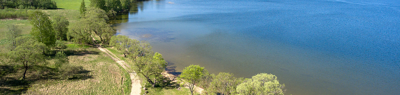
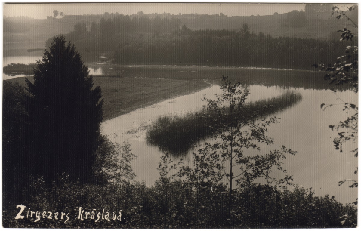
The Latgale Upland is a part of Baltic end moraine – the moraine hill land rich in lakes, which in Latvia is divided by Daugava valley – continues into Lithuania as Aukštaitija Upland, in Belarussia as Braslav Upland, and in Russia as Bezhanitsky and Sudoma Uplands. Latgale Lake District is created on a plain bedrock surface, where a thick layer of glacier moraine is pushed together. The terrain is oscillated here: relatively high hills, rolling land surfaces, steep slopes, rich in river sources, but in comparison with other Latvia’s uplands it stands out with its many lakes. The largest hills in the lakeland are around Lake Rāznas – Lielais Liepukalns, which is the third highest point in Latvia, Dzierkaļu hill, and Mākoņkalns, from which opens magnificent views of the great lake Rāzna, often called “the Sea of Latgale”. Geographer Indriķis Sleinis viewed this restless landscape as “sea waves of hills that disappears into the blue horizon.” Further south the deepest lake of Latvia – Lake Drīdzis and other surrounding chain of subglacial lakes can be seen from the high Sauleskalns hill. Not far away from that is the splendid Lake Sīvers with its many islands, and further to north near Dagda is the lake with the largest number of islands – Ežezers. The islands, often called “the gems of Latgale”, are not only a visual adornment, but a depository of nature values as well. Another close cluster of lakes is around Lake Rušona and Lake Cirišs, full of bays and islands, around many bigger and smaller lakes are located, and the lakes surrounding Ludza together with Lake Cirma. There is a documentary about the lakes of Latgale, created in 1966 – “Balti bērzi aiz ezera” (directed by Varis Krūmiņš).
The most precious scenic values of Latgale Upland landscape are the glacier-made hills and lake valleys with its diverse views that are filled with elements made by both man and nature, which takes breath away for travellers and locals as well. Ontons Zvīdris writes (in Latgalian): “… Kod uzkōpu vīnā kalnā, atsaklāj ainova, kura sevī ītver daudzus cytus kolnus un kaļneņus lejas i pļovas, i azaru, bet vysapkōrt pi horizonta zyls gradzyns. Šys gradzyns ir tik zyls, ka gribīs šaubeitīs par mežu eistineibu…” (“When I climb up the hill, there is a beautiful landscape infront of me, comprising many other trees and hills, meadows and lakes, and the horizon is made of blue ring. This ring is so blue that I begin to doubt the reality of forests…”). When travelling across Latgale, Kārlis Skalbe, like many other authors, points out the beauty of Latgale and the joy, which “can give the innocent and marvelous nature of Latgale, the cheerful hill lines, which slide along the sky in a wonderful pattern; the lush forests, where you go straight in the arms of nature; the lucid lakes in valleys, and, just like small partridges, that come out from fields to drink, small, grey village houses gather.”
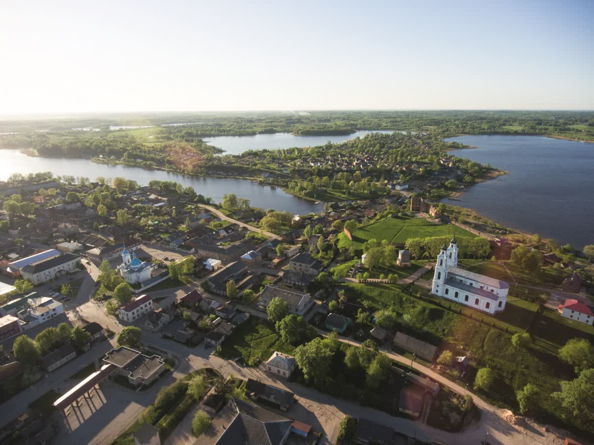
The cultural landscape of Latgale differs from other Latvian historical regions – especially distinct the differences were in the beginning of the 20th century, when the largest part of dense population lived in compact villages with log houses and closed yards, and the fields consisted of “šņoru zemes” (fields divided in long strips of land). Due to the special location of territory and historical conditions, the region ever since has had lots of Russians, Belarusians, Poles and Jews. Its subjugation to Polish–Lithuanian Union, later incorporation in the Vitebsk Gubernia, and the influence of Roman Catholic Church determined the peculiar landscape traits of Latgale, that are still visible in today’s landscape.
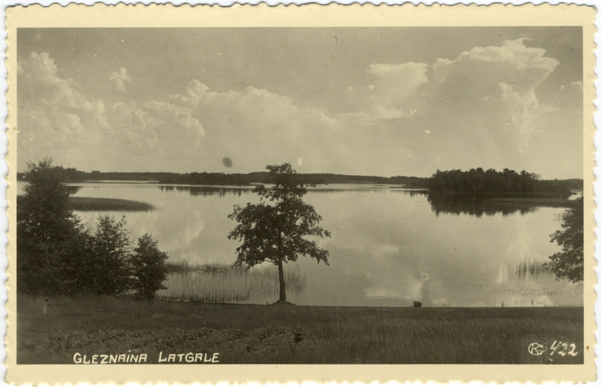
The natural drainage conditions of Latgale Upland advanced the use of land for farming purposes, therefore historically the landscape was open, and forests were very scarce – moreover, fields were covered in the strip field pattern. Important elements were the roads that winded around the terrain, villages, birch groves, churches of different faiths, which had spire so high they could be seen from far away. Between the wars, as a result of agrarian reform, the form of living and agriculture changed drastically – villages were dived in single farmsteads and the practice of strip farmlands within three-field rotation system ended. The landscapes of 20th century beginning, and the processes of their change are portrayed in the painting of Francisks Varslavāns and Vitalijs Kaļvāns; the diverse lake landscapes and far view perspectives can be found in countless postcards.
Latgale is “beautiful in its simplicity with mystical white churches down the hills, with the shining sun and blue lakes,” A. Mačāns writes in the 1920’s. The many churches and crucifixes are significant visual landmarks in the today’s landscape as well.
For the protection of nature and landscape values, in Latgale Upland there has been created specially protected nature territories, such as Rāzna National Park, Nature Parks of Lake Drīdzis, Lake Cirišs and Lake Adamova.
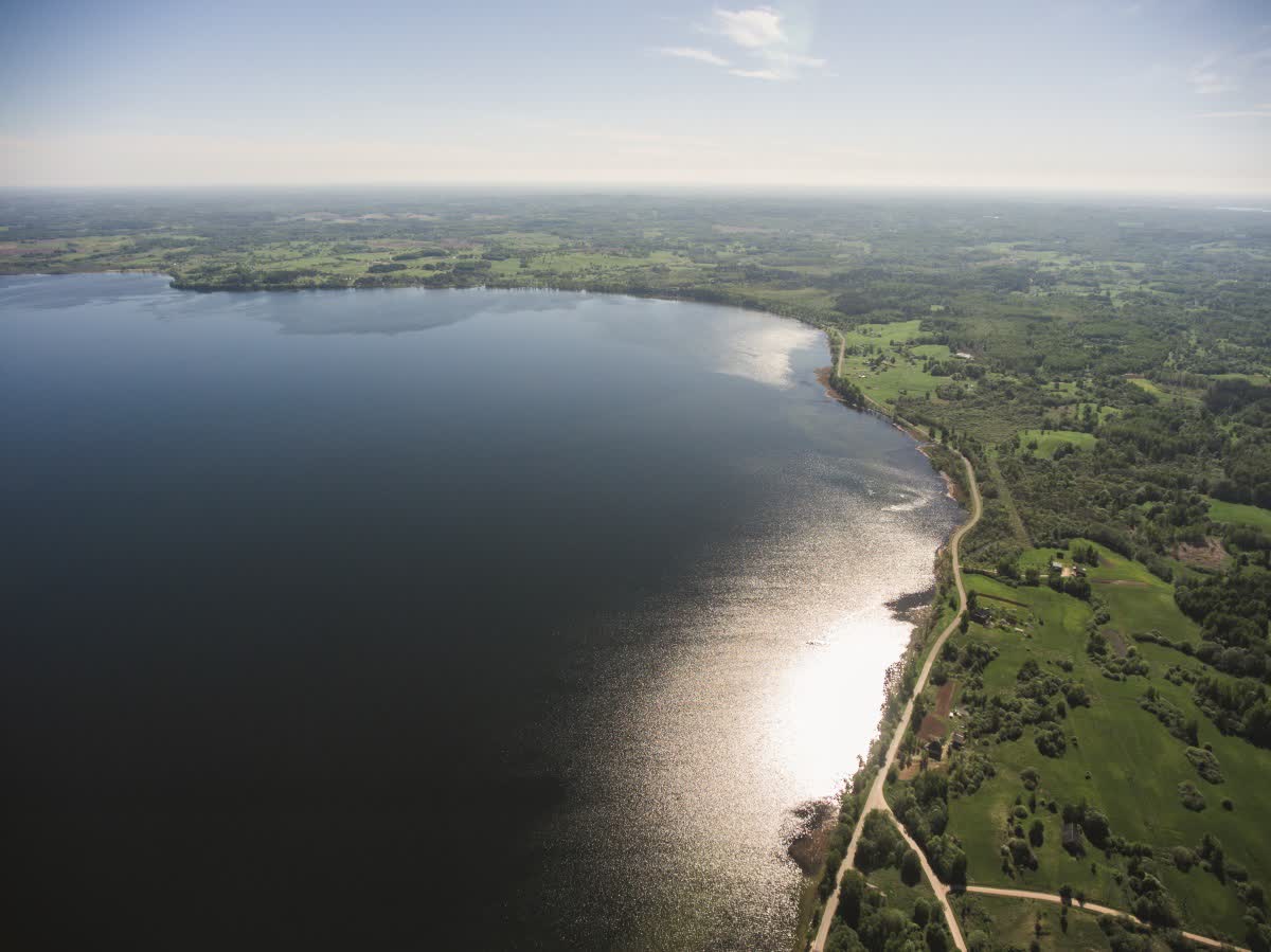
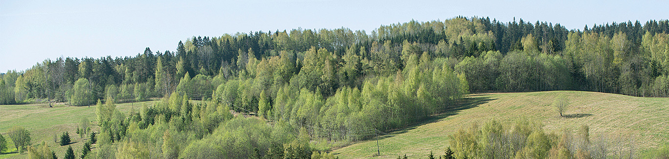
The landscape of Latgale’s lakes has changed considerably during the 20th century – it has become a lot denser with forests and visually more uniform. The mirrors of the lakes cannot be seen so openly anymore, brown and green hills have overgrown with forests, individual birch groves are very rare now, the horizon is not so far anymore. The landscape of today in Latgale Upland is hugely impacted by depopulation and the marginalization of agricultural lands. Nevertheless, the quality of various lake landscapes nowadays is an important resource for developing summerhouses and tourist activities, but the hydrological and biological diversity of lakes is a base for new creative ways of sustainable environmental management.
Anita Zariņa